openindexmaps-workshop
OpenIndexMaps
OpenIndexMaps is a community standard for encoding an index map in the GeoJSON format. provides details and access information about each individual mapsheet or sub-dataset, which can be represented either as points, lines, or polygons.
- OpenIndexMaps.org has the basic specification created in 2018.
It describes a set of common properties that can be used to describe each item (map or sub-dataset) in an index map: available, recordIdentifier, downloadUrl, websiteUrl, thumbnailUrl, iiifUrl, label, title, and note.
Index maps in GeoBlacklight
Currently, GeoBlacklight recognizes just those properties defined by OpenIndexMaps. Any other properties will be ignored and not displayed in the GBL interface. (This may change in the future.)
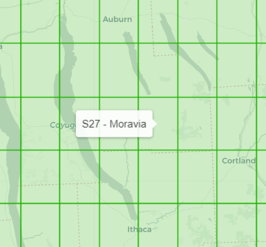
GBL will make special use of the “label” property to provide a mouseover tooltip on the map:
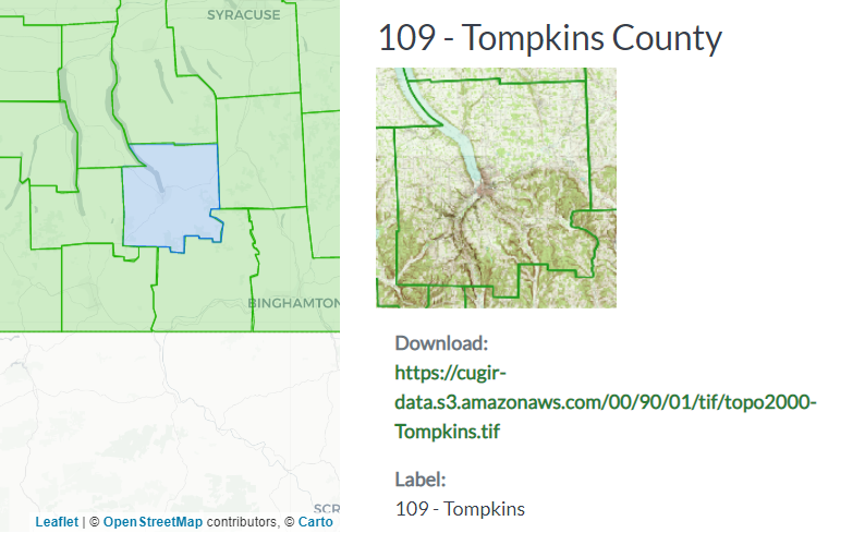
GBL will also display the thumbnailUrl image along with the other OpenIndexMaps property values when a feature is clicked:
Sharing Index Maps
GeoJSON files are shared with others via the OpenIndexMaps organization on GitHub, where several institutions have repositories of index maps:
- github.com/OpenIndexMaps has repositories of index maps by institution
Note that many of the files found in those repos may include other local properties that are not defined (but are still allowed) by the specification. Further work is currently underway to standarize more elements of an index map, including both the data provided for each map or sub-dataset, as well as information about the collection as a whole.
- GIS Index Map Creation Requirements and Recommendations is a draft document currently being developed by a group led by Tom Brittnacher (UCSB)
Next: GeoJSON